This dashboard provides an overview of regional planning activities across Ontario. Get up-to-date with this biannual status update on all planning regions, their public touch points, and the progress and highlights of ongoing Scoping Assessments and IRRPs.
View the Regional Planning Status Map
Regional Planning Dashboard | March 2026
A reliable supply of electricity is essential to supporting community growth – powering homes, schools, businesses, hospitals and transportation. Engaging with communities is an important part of maintaining a reliable electricity supply, now and in the future.
The five planning regions and sub-regions in the GTA and Central Ontario area includes all of the Greater Toronto Area, stretches north to Parry Sound/Muskoka, and roughly spans the area from Meaford to Minden.
The East Ontario area includes four planning regions that spans the area from Port Hope to the Ottawa Valley and Renfrew.
The seven planning regions and sub-regions in Southwest Ontario span from Windsor to Niagara and north to Bruce County.
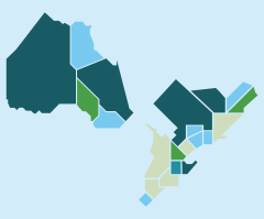
The four planning regions in Northeast Ontario span from Sudbury/Algoma to north of Moosonee.
The Northwest regional planning area includes the area roughly bounded by Lake Superior to the south, the Marathon area to the east, and the Manitoba border to the west. It includes the districts of Kenora, Rainy River and Thunder Bay.